“Stay updated on the evolving threat of a potential cyclone forming off Australia’s east coast. Learn about the high uncertainty, divergent forecast models, and meteorological factors influencing its development. Stay informed and prepared with the latest updates from expert meteorologists.”
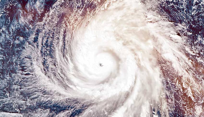
The Bureau of Meteorology (BOM) has issued a warning indicating a significant likelihood of a tropical low developing into a cyclone that could potentially impact Australia’s east coast. As of now, the tropical disturbance is situated over the Solomon Islands in the north-eastern Coral Sea, approximately 1,000 nautical miles north-east of Cairns.
BOM Senior Forecaster Felim Hanniffy has highlighted the potential evolution of the low-pressure system into a tropical cyclone by the following day, with the likelihood of intensifying to a category 3 storm later in the week. However, the exact path and impact on the east coast remain uncertain.
Current Location and Movement
The system is currently consolidating and is expected to drift westward, with a potential southward movement and further intensification. Hanniffy emphasizes the dynamic nature of the system, making it challenging to predict its precise trajectory.
Forecast Models and Uncertainty
BOM modeling suggests a potential trajectory towards the Whitsunday Islands by December 11. However, Hanniffy cautions that nine different tracking models show divergent paths, with some pushing the system westwards towards parts of the Queensland coast. This variability underscores the high level of uncertainty regarding the cyclone’s course.
Severe Weather Outlook
The BOM’s severe weather outlook for the October to April period forecasts fewer tropical cyclones than average. The prospect of a cyclone forming in the Coral Sea during El Niño, particularly this early in the season, is considered rare.
If the system develops, it will mark the first cyclone of the 2023-24 season and be named Jasper if forming in the Australian region. The Fijian Meteorological Service will assign a name if development occurs in Fiji’s region.
Meteorological Factors
BOM Meteorologist Livio Regano attributes the likelihood of cyclone formation to the system’s position on the monsoon trough above a warm ocean. The alignment of the Madden-Julien oscillation and vertically stacked upper atmospheric winds further contributes to the favorable conditions.
Uncertainty in Long-Term Forecast
Regano acknowledges the discrepancy among forecast models and identifies the upper atmospheric wave structure as a significant factor. The chaotic atmosphere makes it nearly impossible to pinpoint the cyclone’s position seven days ahead, introducing a substantial degree of uncertainty.
“A looming tropical disturbance in the Coral Sea teeters on the brink of cyclone status, its uncertain path leaving Australia’s east coast in suspense.”
As the BOM closely monitors the developing tropical disturbance, residents along the east coast are urged to stay informed through official channels. The unpredictable nature of the system emphasizes the importance of preparedness and vigilance in the face of potential cyclonic activity. Stay tuned for further updates as meteorologists continue to refine predictions in the coming days.
Author